
Products for Surveyors and Engineers
Surveying is one of the oldest professions, with records of land surveys dating back to ancient Roman times. The ancient measuring tools for surveying were already developed with surprising accuracy. Romans used an instrument called a groma to “trace on the ground simple and orthogonal alignments necessary to the construction of roads, city, temples, and agricultural lands subdivision.” Since then, surveying instruments have evolved with respect to exponential developments in technology. Today, surveyors use precise electronic equipment in addition to more basic tools to aid in measuring and mapping efforts. Here is the list of the most surveying tools, including:
- Level and rod: A graduated wooden or aluminum rod, used with a levelling instrument to determine the difference in height between points or heights of points above a vertical datum. This tool is used to establish and verify elevations.
- Theodolite and Total Station: A theodolite is a surveying instrument with a rotating telescope for measuring horizontal and vertical angles to make precise measurements of areas and triangulate the position of objects in a specific area. A total station is a theodolite with distance measuring capability and on-board computer to collect data and perform triangulation calculations. This tool is used to record features in topographic surveying or to set out features such as roads, houses, or boundaries.
- Measuring tape/wheel: A length of tape or thin flexible metal, marked at intervals for measuring size or distance.
- 3D scanners: A surveying instrument that can accurately measure and collect data from objects, surfaces, buildings, and landscapes. This tool collects information in the form of point cloud data, which consists of millions of 3D coordinates. These coordinates can be used to create 3D computer-aided design (CAD) models, which can then help analyze topographic features and structures. The high accuracy of 3D scanners helps reduce project costs.
- GPS/GNSS: The use of Global Positioning System signals and/or Global Navigation Satellite System signals via a receiver and antenna to determine the form, boundary, position, objects, or points in space relative to other forms, boundaries, or points. This technology has dramatically increased the speed and productivity of surveyors using on-demand centimeter-level accuracy provided by Real-Time Kinematic (RTK) positioning.
QL Enterprises Inc has been providing all kinds of those devises for surveyors and engineers.
-
 Save 36%
Original price $756.00Original price $756.00 - Original price $756.00Original price $756.00Current price $485.00$485.00 - $485.00Current price $485.00
Save 36%
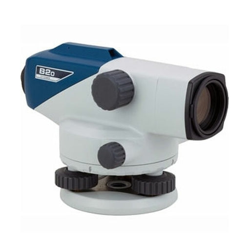
Original price $756.00Original price $756.00 - Original price $756.00Original price $756.00Current price $485.00$485.00 - $485.00Current price $485.00Sokkia B30A-25 28X Automatic Level (1009572-03)
SokkiaSokkia B30A-25 Auto Level, X28, DegreeModel Number: 1009572-03Sokkia B series automatic levels feature enhanced reliability under all environmen...
View full detailsOriginal price $756.00Original price $756.00 - Original price $756.00Original price $756.00Current price $485.00$485.00 - $485.00Current price $485.00Save 36% -
 Save 15%
Original price $4,860.00Original price $4,860.00 - Original price $4,860.00Original price $4,860.00Current price $4,130.00$4,130.00 - $4,130.00Current price $4,130.00
Save 15%
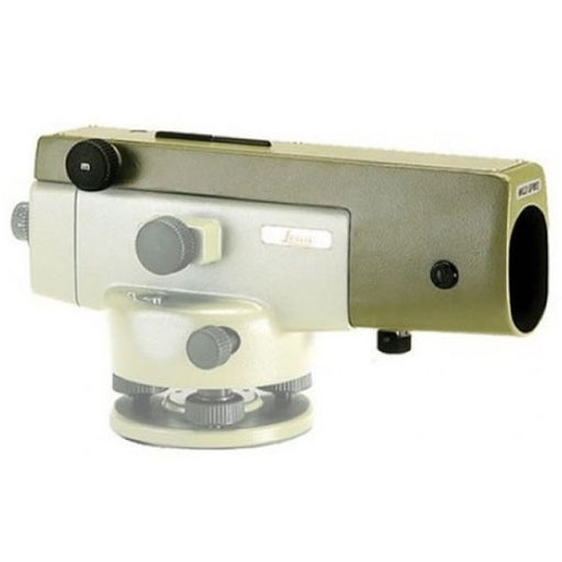
Original price $4,860.00Original price $4,860.00 - Original price $4,860.00Original price $4,860.00Current price $4,130.00$4,130.00 - $4,130.00Current price $4,130.00Leica GPM3 Optical Micrometer for NA2/NA2K (356121 )
Leica GeosystemsThe Leica GPM3 Optical Micrometer for Leica NA2/NA2K Auto Levels is a parallel plate micrometer that helps improve the accuracy of the Leica automa...
View full detailsOriginal price $4,860.00Original price $4,860.00 - Original price $4,860.00Original price $4,860.00Current price $4,130.00$4,130.00 - $4,130.00Current price $4,130.00Save 15% -

 Save 44%
Original price $349.00Original price $349.00 - Original price $349.00Original price $349.00Current price $195.00$195.00 - $195.00Current price $195.00
Save 44%
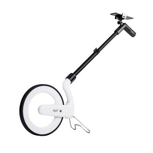
Original price $349.00Original price $349.00 - Original price $349.00Original price $349.00Current price $195.00$195.00 - $195.00Current price $195.00Plott Carta 12.5" Digital Measuring Wheel (demo unit)
PLOTTSave time, money, and headaches by eliminating the need to do complex math on the job. Plott Carta is the first digital measuring wheel to virtuall...
View full detailsOriginal price $349.00Original price $349.00 - Original price $349.00Original price $349.00Current price $195.00$195.00 - $195.00Current price $195.00Save 44% -
 Save 15%
Original price $6,850.00Original price $6,850.00 - Original price $6,850.00Original price $6,850.00Current price $5,822.00$5,822.00 - $5,822.00Current price $5,822.00
Save 15%
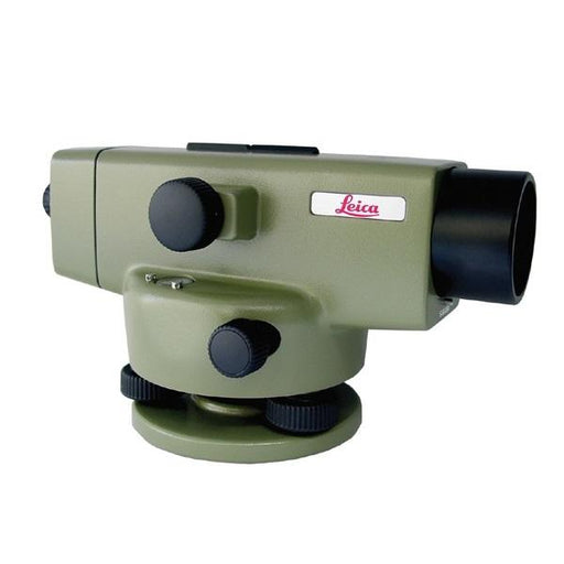
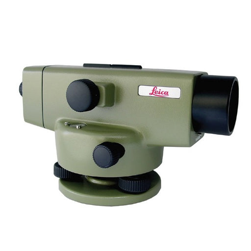
Original price $6,850.00Original price $6,850.00 - Original price $6,850.00Original price $6,850.00Current price $5,822.00$5,822.00 - $5,822.00Current price $5,822.00Leica NAK2 Universal Automatic Level (400gon) (352039)
Leica GeosystemsLeica NA2 Universal Automatic Level (400gon) (352039)Having been designed by Surveyors and Development Engineers with years of experience and who k...
View full detailsOriginal price $6,850.00Original price $6,850.00 - Original price $6,850.00Original price $6,850.00Current price $5,822.00$5,822.00 - $5,822.00Current price $5,822.00Save 15% -
 Save 15%
Original price $6,850.00Original price $6,850.00 - Original price $6,850.00Original price $6,850.00Current price $5,822.00$5,822.00 - $5,822.00Current price $5,822.00
Save 15%
Original price $6,850.00Original price $6,850.00 - Original price $6,850.00Original price $6,850.00Current price $5,822.00$5,822.00 - $5,822.00Current price $5,822.00Leica NAK2 Universal Automatic Level (360°) (352038)
Leica GeosystemsLeica NAK2 Universal Automatic Level (352038)Having been designed by Surveyors and Development Engineers with years of experience and who know what...
View full detailsOriginal price $6,850.00Original price $6,850.00 - Original price $6,850.00Original price $6,850.00Current price $5,822.00$5,822.00 - $5,822.00Current price $5,822.00Save 15%


